Solo Kayaking in Desolation Sound, BC
In June 2018, I had to be in Vancouver for work and figured I’d use the opportunity to tack on a trip. Up to then I hadn’t done any real tripping outside of Ontario, and was really excited at the idea of kayaking the coast of BC. I generally do one solo trip every year and, unable to convince my usual camping buddies to travel cross-country, this ended up being the one.
Without any knowledge of routes and parks in BC, I turned to Reddit to get some advice on the best spots. A few folks mentioned Tofino and the Broken Group islands, but warned that they’re highly trafficked. Others suggested the North Coast of the island, in an around Telegraph Cove, but with only three nights to spare it was a bit too far. (Worth noting, I did convince a few adventurers to join me up in the Broughton Archipelago this fall - so we’ll be back that way in a few months!).
One Redditor ended up reaching out to me in a private message and spilled some quality intel. He (or she) suggested checking out Desolation Sound - a marine park just north of Powell River, and a quick hop from Vancouver. After checking out a few pictures (and lifting my jaw off the floor) I was sold, and started planning.
You’ll find Desolation Sound just east of Campbell River.
The Route
Tucked away on the northern end of the Sunshine Coast, Desolation Sound is a group of coves and islands world-renowned by sailors and paddlers. Some 60km of shoreline has been protected since 1973 as a marine park and, despite some residential development and logging in the area, it looks pretty untouched. I’ve heard there’s plenty of boat traffic in the summer, but June is the shoulder season so I was promised a bit of peace and quiet.
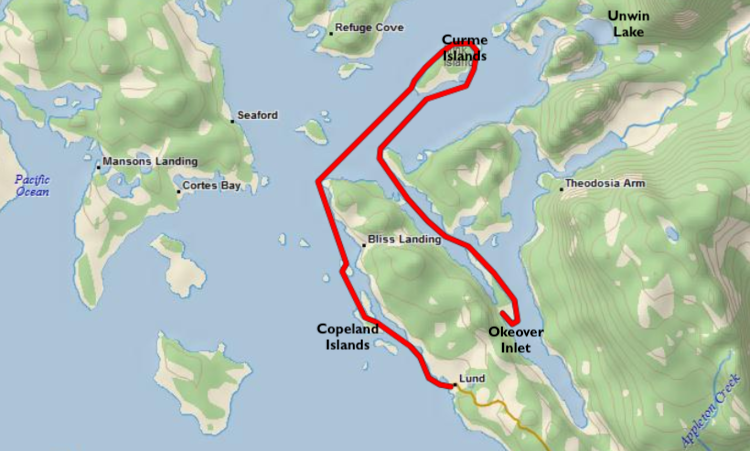
I planned a four-day/three-night route that would take me from the Okeover Inlet, up to the Mink and Curme Islands, and back down to Lund. The route was only about 40km, but being in saltwater for the first time and solo, I wanted to keep it pretty simple. (In hindsight, I should have done this the opposite way because of prevailing winds. But then again if I did that I wouldn’t be living up to the name of the blog...)
My route from the Okeover Inlet back into Lund.
I had the loose idea of staying on the Curme Islands and the Copeland Islands in some combination, with a couple day trips to explore the area. Because it’s all contained in the park, there are designated campsites all over the place.
One interesting curveball I came across planning for a paddle in BC is managing your water. You can’t just dunk your Nalgene off the side of the boat. So I picked up a 10L MSR Dromedary water bladder that I could stretch for four days if I absolutely had to, but was hoping I’d find a source of freshwater somewhere along the way.
The Trip
The first challenge with this trip was actually getting up there. From Vancouver, you can take a couple ferries and drive the Sunshine Coast, which I’ve heard is beautiful, but I didn’t have a car and it’s quite a ways - about 5 hours from the city. I ended up booking a flight on Pacific Coastal airways to Powell River, and booking a shuttle to the Okeover Inlet through Sunshine Coast Shuttles. Combined, the cost was only a few hundred bucks and the whole trip took a couple hours.
My chariot.
Generous headroom (but still had to bend at 90˚ to get to my seat).
I had booked my boat with Powell River Sea Kayak, who have locations in Okeover and Lund. This meant I could grab my kayak at one location and return it to the other for a few bucks extra, which was a bonus. I’d left Vancouver at 10am, and was in my kayak paddling up the Okeover Inlet by noon.
Day 1 was roughly 17km, getting from the Inlet and out into the Sound, and I decided to scope out the Curme Islands first. The Curmes are a small chain of islands with over a dozen well-developed campsites - tent platforms, an outhouse, some picnic tables and benches. You’re not allowed to have campfires, but it’s a fair compromise for the luxury of a well-maintained site. After a rainy and windy paddle, I settled in alone on the island for the night.
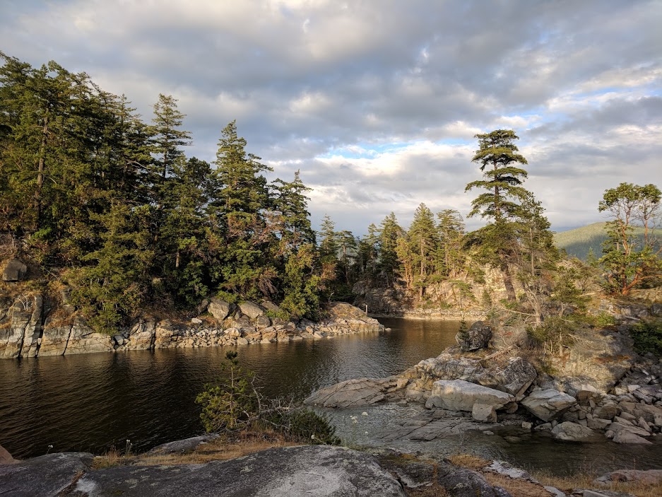
The view from one of the tent platforms on West Curme Island.
My campsite was so spectacular, I decided to settle in and stay around another day. This gave me time to explore the island and head across the bay to Unwin Lake, where I was hoping to refill my water supply.
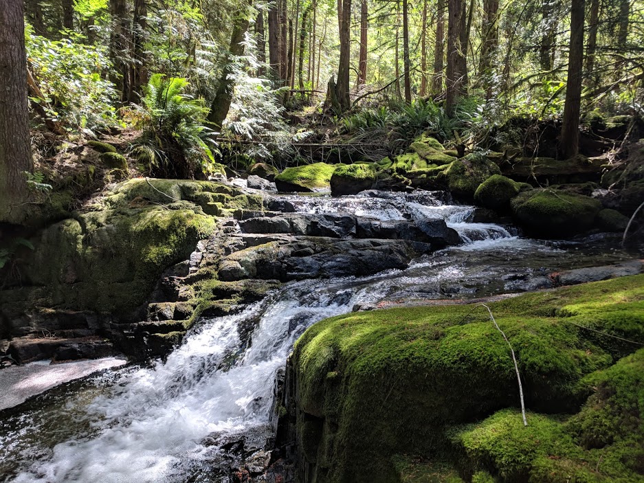
The route to Unwin Lake takes you across the Sound to a quiet bay, where you’ll find a couple more well-developed campsites carved out along a bubbling stream. It’s a short hike up to the lake, and absolutely worth the trek.
The silent hike up to Unwin Lake.
There had obviously been some logging in the area some time ago, and hundreds of logs jammed themselves up where the lake filters down into the stream. It was a bit cold for a dip, but I refilled my water stash and found a nice spot to have lunch on top of the log jam. Afterwards, I packed up and headed back to my site for the night.
The log jam on Unwin Lake.
One variable I’d considered when planning (but admittedly not considered enough) were the tides. We don’t have to worry about tides back in Ontario but, holy hell, they are very much in play in BC. During my trip, the tides had a range of about 8 feet (!) and made for some very challenging entries and exits.
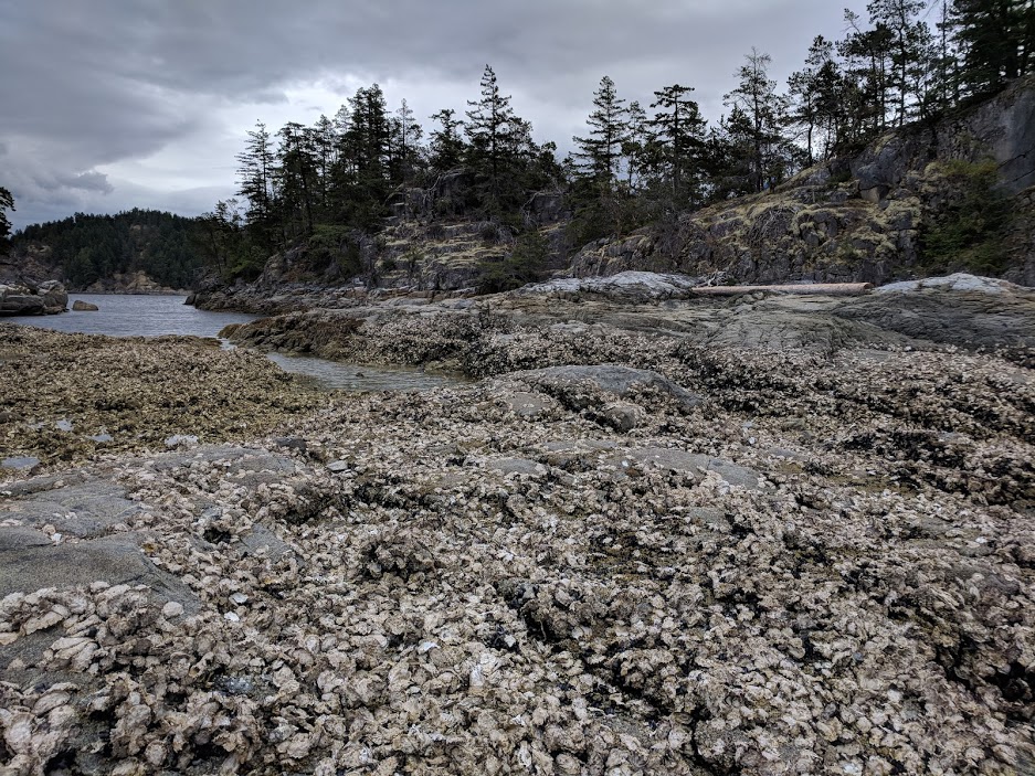
If the tide is high, you’re golden. But in a low tide you’re stepping precariously over slippery seaweed and razor-sharp oysters to get in and out of your kayak. Because the high and low times change every day, deciding when to make and break camp requires careful planning. Luckily, tides are very predictable and you can get the information you need months in advance from Fisheries and Oceans Canada.
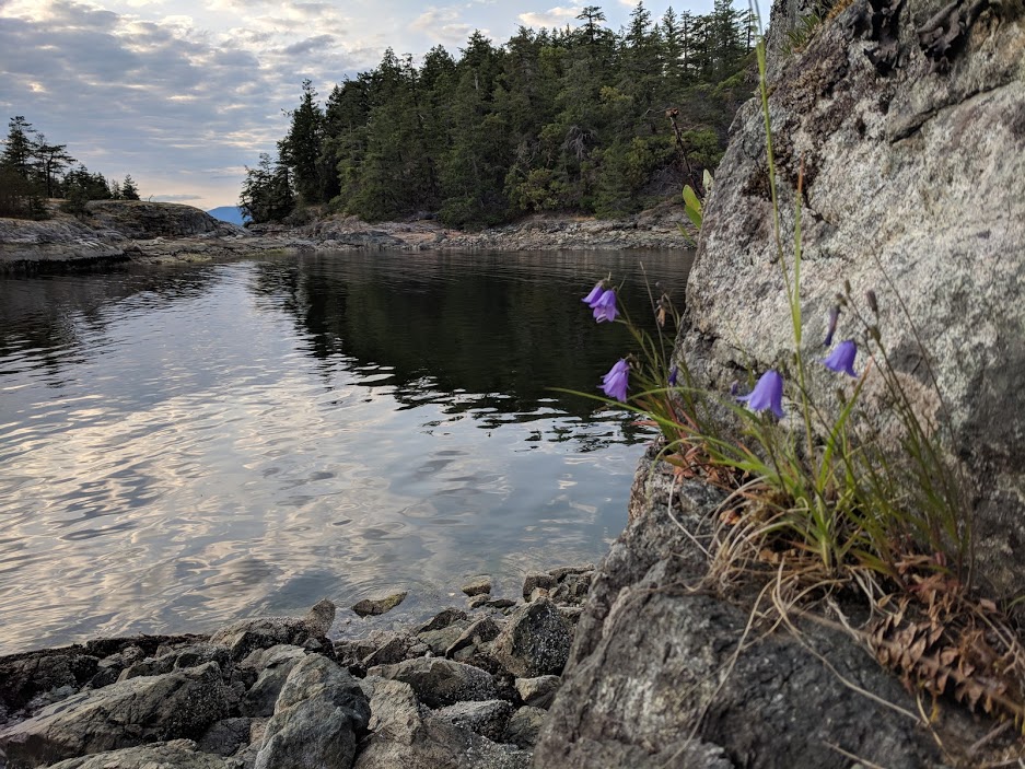
Low tide on Day 2. My kayak is in the exact same spot as the first pic in this post!
In the afternoon on Day 2, a fairly large group of kayakers had arrived at the island, and we ended up sharing the space for the night. They were a lovely group on a Spirit of the West expedition, and we enjoyed some wine and desserts before hitting the hay. The next morning, I broke camp and started the 14km paddle down to the Copeland Islands for my last night.
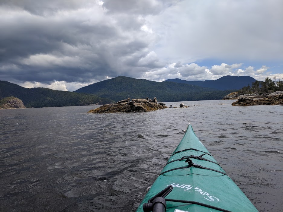
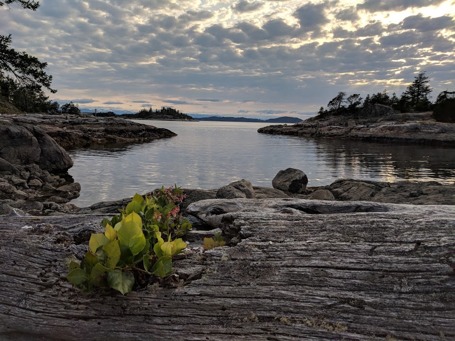
On my way out of the Sound and into the open channel, I was swiftly reminded that I was on the ocean. The wind picked up, and before I knew it I was taking 3-4 foot waves over the bow and riding massive swells between them. Thankfully, these massive fiberglass sea kayaks can take a beating. I surfed into the North Copeland Islands and found a beautiful site in a quiet cove between the islands.
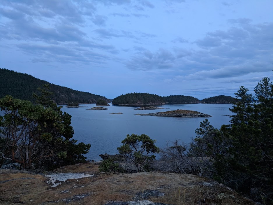
A quick hike up a hill on the island rewarded me with this view.
The campsites in and around Desolation Sound have absolutely spoiled me for camping anywhere else. Well-constructed wood platforms kept me off the ground, and with it raining every few hours that made a huge difference. There were tables for cooking and well-kept outhouses nearby.
I absolutely could have posted up here for another few nights (once again, being the only guy on the island) but had to start the long road back to civilization the following day.
My campsite on one of the North Copeland islands.
I broke camp early on Day 4, finally getting cell service and reading that winds and rain were supposed to get pretty hairy later in the morning. Apparently I didn’t break camp early enough because I was absolutely manhandled by wind and waves throughout the entire 8km paddle back into Lund. Truthfully, I can say I’ve never experienced waves like that before.
Luckily the route is well trafficked, and multiple boats approached me in the channel and yelled over to ask if I was alright, which simultaneously made me feel safer (knowing I could get bailed out) and less safe (knowing pretty much everyone figured I needed help). Having boats nearby helped keep my head straight, and I landed safely in Lund in a little over an hour. (Oddly enough I find I actually move faster in a headwind because unlike in a cushy tailwind, you have to paddle at max power with no breaks).
After returning my gear, I hopped a shuttle back to the airport, a flight back to Vancouver, and I was sipping a Negroni in Coal Harbour by dinner time.
Itinerary
Day 1: Okeover Inlet to West Curme Island (17km)
Day 2: Island day and Unwin Lake Hike
Day 3: West Curme Island to North Copeland Island (14km)
Day 4: North Copeland Island to Lund (8km)
Pro Tips
There is no such thing as having too much information when you’re planning for an ocean trip. Topographic maps, tide tables, marine charts, and on-demand weather reports are all extremely valuable, and I wish I had done more due diligence here.
Seasonality is a big factor on weather and crowds. High season out here is June-September, so if you’re looking to avoid crowds plan your trip on the shoulders. (i.e., early June, or after Labour Day). If you want to see whales, I understand August/September are best.
Lean on the outfitters for intel. They know the area, and can give plenty of advice on the best spots and places to go. I also recommend paying $25 to get full access to the BC Marine Trails maps, which have plentiful data on campsites and areas of interest. Also they’re awesome and deserve the support.
Cell reception is spotty, so bring a VHF radio or an SOS device in case of trouble.
Editor’s note: I did this trip before I had my GPS, so unfortunately I don’t have defined coordinates/tracks to share. Luckily the folks at BC Marine Trails have already done most of the work, and you can download GPX/KML files of the area from their maps. Likewise, I didn’t track my food so I don’t have that information for you either. Next time - I promise.
