Hunting Headwinds

  • Trips
  • Gear
  • Conservation
  • About

BC Marine Trails: Linking and Protecting the BC Coast

September 24, 2022 by Andrew Godfrey in Conservation

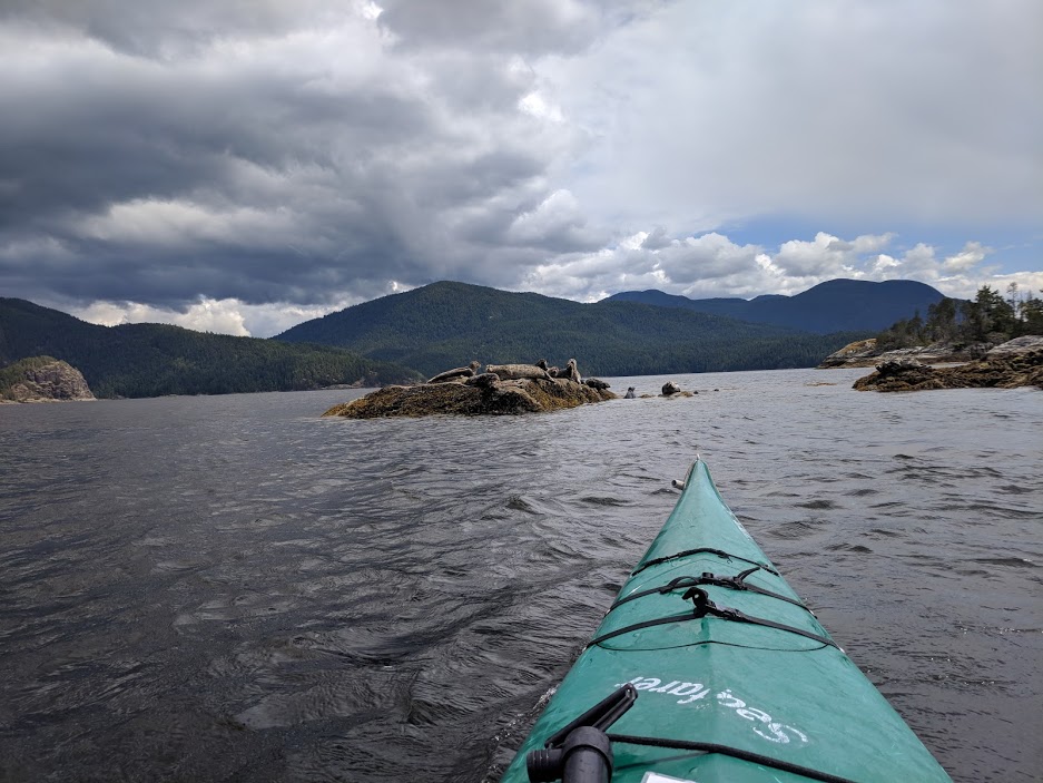
One of the more complicated parts of organizing a big trip is connecting routes to campsites. Especially when you’re adventuring outside of the boundaries of formal parks. It requires tons of research and planning to find a safe (and achievable) route, and generally you end up taking any advice you can get.

I came across an incredible organization called BC Marine Trails, and they’ve become an invaluable asset for planning a kayak trip in BC.

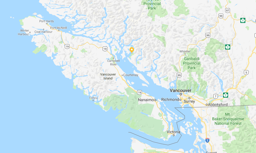
BCMT is working hard to connect the BC coast, all the way from Washington to Alaska, with safe and clean campsites. The organization’s goal is to have an unbroken chain of well-maintained sites, each no more than a day’s paddle apart. And they’re doing this without owning a single square foot of land.

Between the complexity of negotiating across private/public/First Nations landowners, and managing a database of sites in some of the coast’s most remote areas, it’s a hell of an ambition. It was so inspiring that I joined the board of directors in 2021 to offer any help I could.

If you’re planning a kayaking trip in BC, this is an organization you’re going to want to support. Here are a few reasons why.

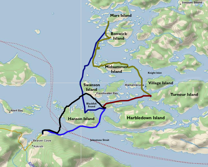
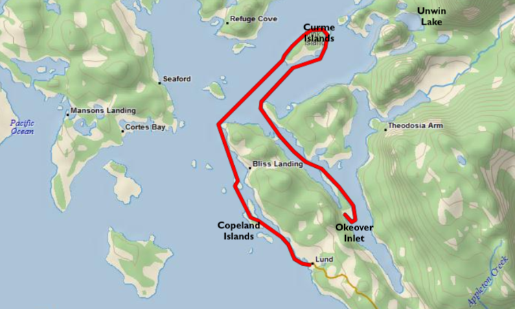
In connecting the coastline, BCMT has amassed a deep database of campsites of all kinds. You can access the map for free online, and paid members have some extra features including a route planning tool, and the ability to download site data for GPS devices.
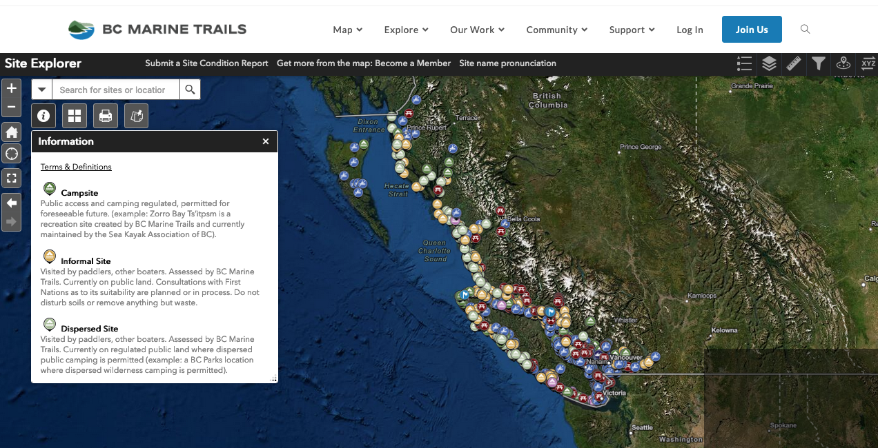
The BCMT Map tool

Our organization is working hard alongside First Nations, governments, and private landowners to grow the list of sites across and make travelling the coast even more accessible. Our Code of Conduct helps educate paddlers on how to visit the coast responsibly and respectfully.

Removing ivy at Gerald Island. Photo by V. GIbberd.

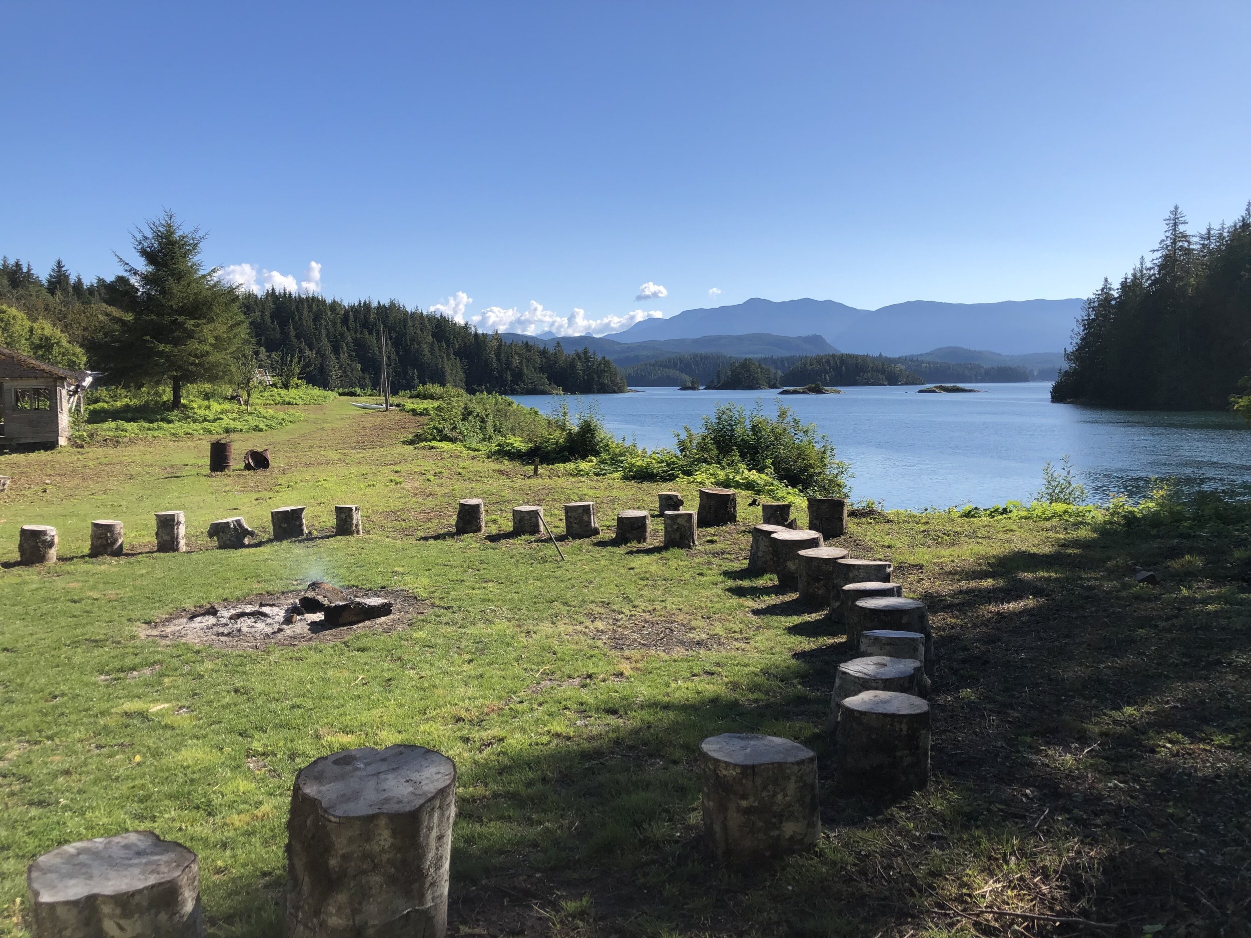
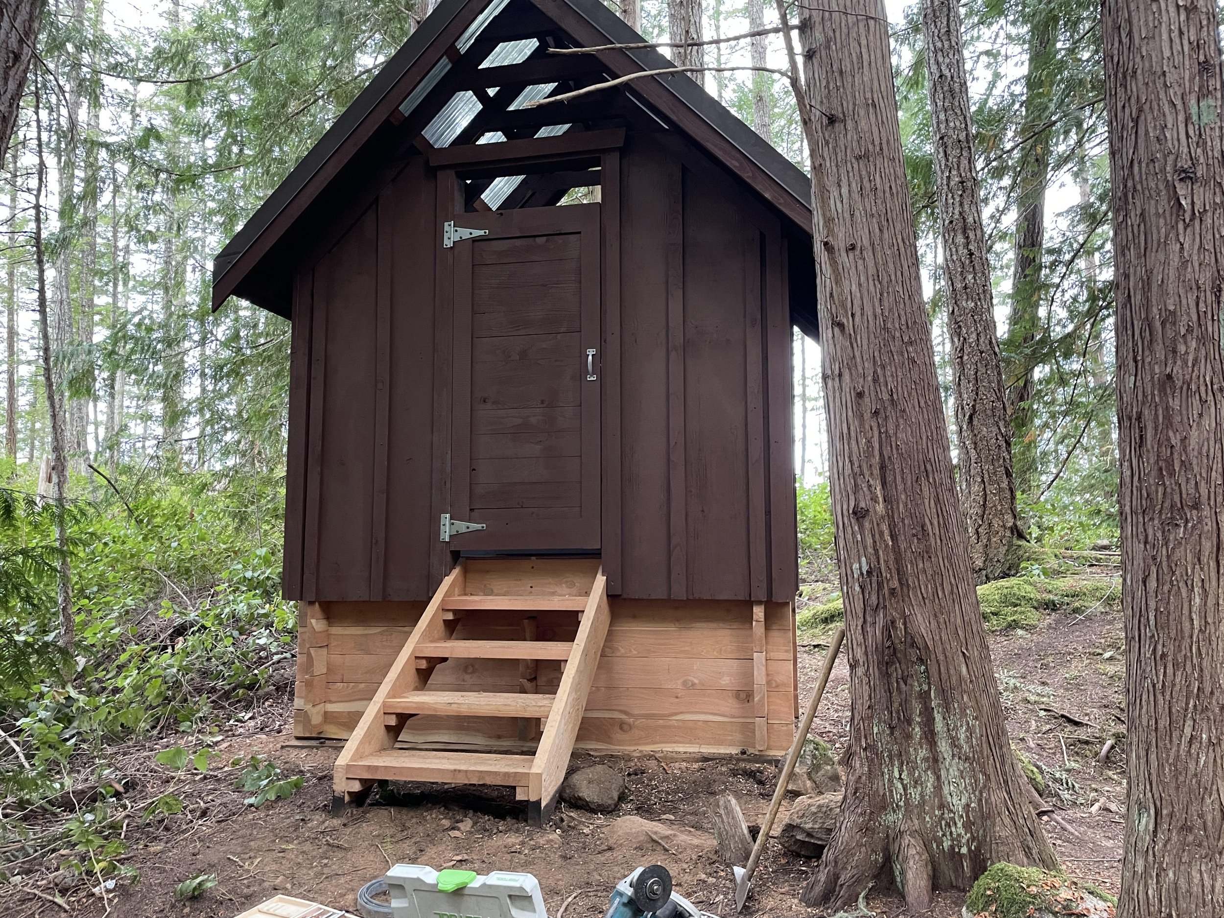
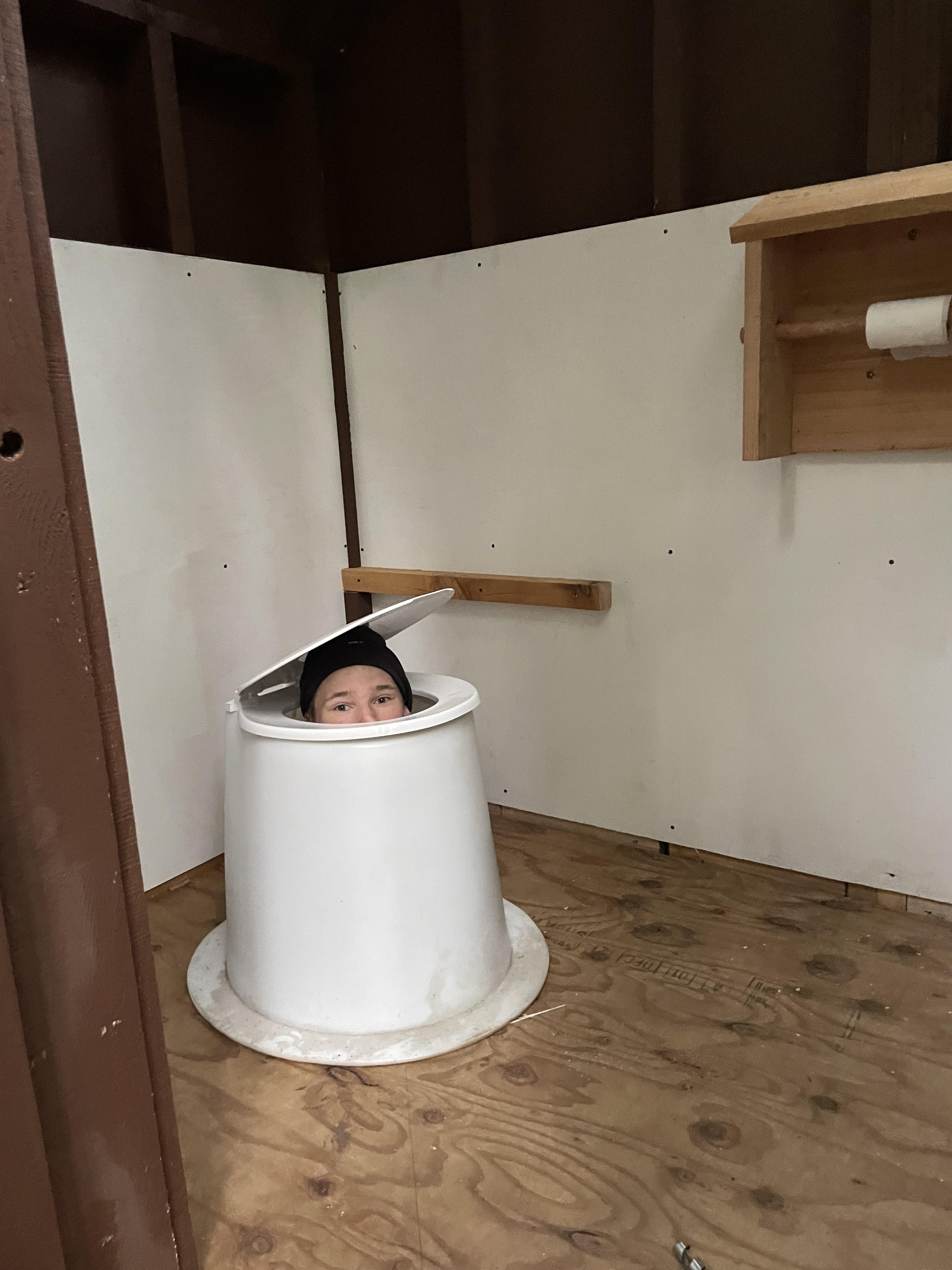
Sites are regularly visited to take condition reports and tidy them up from garbage and invasive species. Where possible, we work to add some level of infrastructure to make your trip even more comfortable. (Like the new composting toilet at Freedom Point in the Discovery Islands!)

freedompointtoilet2.jpg freedompointtoilet1.jpg

Lastly - members get some amazing discounts on tours and kayak rentals all along the coast.

A membership will cost you $30 a year, and I will tell you (in a completely unbiased way…) that it’s worth its weight in gold - especially as you plan your next adventure in BC.

Join BC Marine Trails today!
September 24, 2022 /Andrew Godfrey
BCMT, Kayaking
Conservation
bustardsfirepit.jpg

Kayaking the Bustard Islands

February 24, 2021 by Andrew Godfrey in Trips

It doesn’t seem to matter how many times I paddle Georgian Bay - every trip is different and each one leaves me wanting more. I can’t shake how lucky I feel to live so close to the most beautiful coastline in the world.

After surviving a winter trip with Jake and Jeff, we quickly made plans to spend another week out in the wilds and settled on a mid-summer trip to the playground that is French River Provincial Park. It’s one of the few places I’ll consider camping in July in Ontario; the Georgian Bay winds provide a much needed shelter from summer heat and bugs.

Screen Shot 2021-02-24 at 10.22.34 PM.png

Hugging the north-east coast of Georgian Bay, the French River park boasts staggeringly beautiful landscapes and, compared to Algonquin and Killarney, it sees very little traffic. Being a fairly new park (est. 1989), you’ll see the occasional cottage and fishing camp, but otherwise it’s an excellent spot for a taste of solitude and scenery.

As the name suggests, the park follows the French River as it empties Lake Nipissing into Georgian Bay. It’s the track that Samuel Champlain took when Europeans first arrived at the Bay, with Voyageurs following the same route for centuries to exploit the area for the fur trade. There is no shortage of paths from the main channel into the bay, with the river emptying through multiple arms - giving a backcountry tripper lots of options.


The Route

With a couple guys who haven’t spent much time in the area, I wanted some general exploration but ultimately to highlight a special part of the park: the Bustard Islands.

The Bustards are a bit of a geologic anomaly. They cover a significant landmass, are unusually far offshore, and are reasonably undeveloped. On windy day, it can be difficult to even get to them in a kayak (and impossible in a canoe). So for a few guys with time to burn, it was a perfectly reasonable target.

Our route - all in all, around 110km.

Our route - all in all, around 110km.

We carved off a full calendar week for the trip, which left us with tons of options for a healthy loop. In the end we decided to launch from the Pickerel River Marina, connect with the French and ride the West arm to open water, curl back East to the Bustards, and head home up the main channel. We covered around 110km over seven days (only five of which were spent between sites).

I had hoped to do some exploring around Fox Island to the East, but we didn’t get quite that far. And it’s always nice to leave something for next time.


The Trip

I’ve been up to this area twice in recent years, and introduced the Pickerel River segment to shake things up a little. It saved us some driving and gave us a bit more distance to play with. Water levels were insanely high in 2020, so we had very little swift water to worry about in either direction. There are plenty of campsites along the Pickerel, although they can be widely spaced so plan accordingly. As it approaches the French, the Pickerel bends and carves through some incredible channels and valleys. If you can afford the time, it’s far superior to the segment from Hartley Bay to the main junction of the French’s ‘figure 8’.

Carving through cliffs on the Pickerel River.

Carving through cliffs on the Pickerel River.

As much as I love tracking new routes, some are just too perfect to change. I had to take the boys through the Old Voyageur Channel, which I highlighted on my 2019 route around Philip Edward Island. The water levels were much higher and the rapids less exciting, but the channel always reminds me why I keep coming back.

In true Georgian Bay form, reality didn’t set in until we hit open water. Winds picked up dramatically and didn’t let up for the rest of the trip. The title of this blog isn’t just some playful alliteration. I am a fucking headwind magnet.

Landing in Green Bay, we found ourselves at the westernmost point of the park. We settled in at a glorious island site for two nights - spending our days surfing waves, drinking swampy bay water, dodging rattlesnakes, and soaking in sunsets.

Shoals around Green Bay, the Westernmost point of the French River park.

Shoals around Green Bay, the Westernmost point of the French River park.

After a couple days of island life, we saw a window of sub 15km/hr winds and decided to make our 10km push across open water to the Bustards. Aside from Jake’s rudder popping off ten minutes into the trip, we had little friction getting to the Bustard lighthouses and began our hunt for a campsite.

Despite the vast landmass of the Bustard Islands, there are only a handful of campsites marked on the map. This would create a bit of a challenge if you got all the way out there and all were taken, and indeed we saw plenty improvised sites along the shoreline. Not ideal, but in a pinch you can make it work. At this point we still hadn’t seen anyone in days, and we settled in at a beautiful and quiet site nested in the belly of Tanvat Island.

Traversing the bay towards the Bustard Island lighthouses.

Traversing the bay towards the Bustard Island lighthouses.

We decided to stay another night on the Bustards, but ended up moving out to the coast after being accosted by in-land mosquitos. The exposed point we settled at was stunning, rugged, and certainly the highlight of the trip for me. You can see it in the headline picture of this post!

For our final push back up-river, we chose the Canoe Channel route back towards the French. I hadn’t gone this way before and was so pleased we did. The cliffs and canyons made for a gorgeous detour back to our original route, which we traced back to the marina the following day.

Sunset on the Pickerel.

Sunset on the Pickerel.

Itinerary
Day 1: Pickerel River Marina to Pickerel River (17km)
Day 2: Pickerel River to Green Bay (27km)
Day 3: Island day (no travel)
Day 4: Green Bay to Bustard Islands (16km)
Day 5: Island day (no travel)
Day 6: Bustard Islands to Pickerel River (23km)
Day 7: Pickerel River to Pickerel River Marina (17km)


Hot Tips

With Georgian Bay trips it’s good practice to pick a start and finish point, a general route, and leave yourself plenty of flexibility to make changes based on wind/mood.

As of July 2020, there is a massive wind power installation around the Henvey Inlet at the Eastern arm of the park. Thumbs up for renewable energy, but it’s absolutely hideous. Flashing red lights all through the night. Try to snag a West-facing site in this part of the park.

There are only a handful of sites on the Bustards. If you’re in peak season and worried about not getting a site, start your trip on a Thursday or earlier. Weekend traffic may pick up, but mid-week things are dead.

 All you can eat!

All you can eat!

 I’m not sure it ever gets dark in Green Bay.

I’m not sure it ever gets dark in Green Bay.

 The gorgeous rock formations once you reach the Bustards.

The gorgeous rock formations once you reach the Bustards.

 A rare visitor joined our hangout circle.

A rare visitor joined our hangout circle.

 Lunch Break on the French.

Lunch Break on the French.

 Canoe Channel cliffs falling into the French.

Canoe Channel cliffs falling into the French.

 A glassy morning paddle.

A glassy morning paddle.

 All you can eat!  I’m not sure it ever gets dark in Green Bay.  The gorgeous rock formations once you reach the Bustards.  A rare visitor joined our hangout circle.  Lunch Break on the French.  Canoe Channel cliffs falling into the French.  A glassy morning paddle.
February 24, 2021 /Andrew Godfrey
Georgian Bay, French River, Bustard Islands, Kayaking
Trips

Kayaking BC’s Broughton Archipelago

December 29, 2019 by Andrew Godfrey in Trips

After a trek into BC’s Desolation Sound, I knew I’d be back. In fact, I started planning the next trip almost immediately.

Throwing darts at a map, I noticed a cluster of islands near Port McNeill, on the north-east side of Vancouver Island, called the Broughton Archipelago. After looking at some photos on Google it took me all of ten minutes to decide that this was the spot for my next BC tour.

I had initially planned on a solo, but the more I talked about the trip the more interest I had. To be honest, I was kind of relieved - this area was a lot more exposed and remote than Desolation Sound, and I was glad to have some company. Two pals (Chris and Tyler) ended up following through, and in September 2019 we landed in Nanaimo ready for some adventure.

Screen Shot 2019-09-17 at 12.29.52 AM.png

The Route

From the northern tip of Vancouver Island, the Pacific wind blows down the Queen Charlotte Strait past Port Hardy, Port Macneill, and eventually it hits a chain of islands and the Broughton Archipelago Marine Park. Established in 1992, it’s BC’s largest marine park and has over a hundred (varied-quality) campsites peppered across native, public, and private land. The area also crosses the Johnstone Strait and Blackfish Sound, both endearingly referred to as ‘whale soup’: a superhighway for orca and humpbacks. I’d never paddled with our distant cousins, but was excited at the idea.

I came across the folks at BC Marine Trails, who have amassed an ocean of campsite data. With their generous help, I was able to piece together a number of possible routes. It’s worth mentioning that the Archipelago is remote, but well-known - it shows up on tons of sea kayaking Top 10 lists. Even after Labour Day, I was assured we’d see other folks out there and that we may have to contend for campsites.

Our five-day/100km adventure. In order: black, red, green, purple, blue. Download GPX file here.

Our five-day/100km adventure. In order: black, red, green, purple, blue. Download GPX file here.

Starting out of Telegraph Cove we’d planned a 5-day/4-night route that, truthfully, was pretty loose. I’d heard lots about tides and currents in the area, and had no idea what our pace would be. The plan was to cross the Johnstone Strait and see how far we could get, turning back a few days later and finishing in Telegraph Cove.

Above you’ll see the actual route we pulled off. All in all, just over 100km. I had a rough idea that we should see Village Island (more on that later), and we should get beyond the Knight Inlet and into the northern part of the park. We were traveling just after a new moon so the tides were at their highest, which meant the currents were at their strongest, so ultimately they decided where we went.

In planning, I was also reasonably conservative with crossing such big segments of open water. We tried to limit that as much as possible, but ended up with perfect weather so we did it anyways!


The Trip

Air Canada just started direct flights from Toronto to Nanaimo, which made it a great rally point. We rented an SUV and ventured four hours north - past Comox (where we picked up kayaks at Comox Valley Kayaks and Canoes) and into Telegraph Cove, a tiny town with a vibrant history. Today, Telegraph Cove is owned by a resort and made for a phenomenal base camp. We were able to rent a cabin the night before launch, and grab a hot dinner/cold beer(s) at a restaurant in the harbour.

Our cozy foggy basecamp in Telegraph Cove.

Our cozy foggy basecamp in Telegraph Cove.

On Day 1, the plan was simply to cross the Johnstone Strait and find a spot along the southern coast of Swanson Island or the western bay of Harbledown Island. We timed our launch with the tide, but were met with a common adversary in BC: fog. We could see all of twenty metres in front of us. We crossed the channel and made it into Blackfish sound, where we found… more fog. We had lunch and hoped it would pass, which it did briefly, and we powered across the bay to sounds of humpbacks breaching and ships cruising in the mist.

We were ready to settle in at Flower Island when a group of passing kayakers warned us there was a grizzly sighted there all of 45 minutes prior. Heeding the warning, we quickly crossed the channel to Parson’s Bay where we posted up at a sandy site on Red Point with a perfect view of Blackney Passage.

The very paintable view from Village Island back towards Vancouver Island (in the distance).

The very paintable view from Village Island back towards Vancouver Island (in the distance).

Day 2 took us eastward to a small cove on Turnour Island. The site was rugged, but at medium-to-low tide we had a nice midden beach and a rocky shoal to sit and watch the sunset. We caught a favourable current on the way out to Turnour, which left us with a lot of time on our hands - enough to make a day trip to Village Island, the former home of the Mamalilikulla First Nation. The island holds some interesting relics and abandoned buildings, and it’s necessary to clear your arrival with the nation before visiting.

Day 3 was… interesting. After another foggy start, we mistimed a current and got held up for a long lunch. By the time the current had calmed, we had lost quite a bit of time with a lot of distance to go. We passed several occupied sites, including one that served as a base camp for protestors of the local fish farming industry. (They won, by the way!) The Broughtons are light on places to camp, so we ended up tracking over 25km on Day 3, finally arriving at a secluded campsite in Spiller’s Passage, between Mars and Hudson islands.

Questionable docking locations abound.

Questionable docking locations abound.

Following a late night where we celebrated our survival (after a field injury involving an impressive fall off a ten-foot cliff) we woke up late to a calm and sunny Day 4. This gave us the option of an open-water paddle, and turned into the greatest day I’ve ever spent on the water. Humpbacks breaching everywhere you looked, a swift current (in the right direction, for once), and a perfect view of mountains made for happy paddling. We made incredible time and decided to return to our beach site at Red Point for our last night.

An amazing bluebird day on open water.

An amazing bluebird day on open water.

In the spirit of the rollercoaster ride that was this trip, our final return to Telegraph Cove on Day 5 was nothing short of terrifying. We had to beat a current early in the morning, which meant departing into another pea-soup fog. It’s difficult to express how uncomfortable it is to hear (but not see) whales breaching a mere ten metres away, or to have a sea lion pop up at the bow of your kayak and show you its massive teeth. Beautiful, but highly uncomfortable. We beat the current, and made it into the Johnstone Strait (crossing, again, in a deep fog - not ideal) for a leisurely paddle home as the tide ebbed out.

I’m sure there are mountains back there somewhere..

I’m sure there are mountains back there somewhere..

Itinerary (GPX file)
Day 1: Telegraph Cove to Parson’s Bay (17km)
Day 2: Parson’s Bay to Turnour Island (18km)
Day 3: Turnour Island to Mars Island (25km)
Day 4: Mars Island to Parson’s Bay (21km)
Day 5: Parson’s Bay to Telegraph Cove (14km)


The Food

The big complexity in meal planning for this trip was that I didn’t have my trusty cooler, so keeping food frozen wasn’t practical. I also wanted to avoid meat as much as possible because I heard grizzlies like meat, and I wanted to avoid grizzlies.

We didn’t have the benefit of a home kitchen to prepare anything, so we basically took stuff right off the grocery store shelf and into our bag. Once again, we did our own breakfast and lunches (which I highly recommend) and shared dinners. Think boxed PC White Cheddar Mac and Cheese, a curry kit, and Mr. Noodles repurposed with various sauces. Some day I will document some of these recipes.

Meal Plan
Day 1: Thai Green Curry with Lentils (Using a package like this)
Day 2: Mac and Cheese w/ Salami
Day 3: Knock-off Dan Dan Noodles w/ Tofu (Mr. Noodles, firm tofu, and a bottle of this peanut sauce)
Day 4: Poor Man’s Carbonara (w/ pancetta, Mr. Noodles, eggs, parmesan, pepper)


Pro Tips

  • Get a membership at BC Marine Trails. They have awesome campsite data you can download into your GPS, and you get 20% off rentals at Comox Valley Kayaks and Canoes. I would not have had as much fun as I did without their help.

  • Study the tides and currents of your route (a lot), and be flexible to the possibility you might have to change your plans.

  • There is some cell service, but consider getting a GPS. Fog is common and it can completely destroy visibility. Having a clear read on bearing and route is essential.

  • If you’re interested in an A-B route instead of a loop, there are water taxis in the area that could take you out at the beginning (and you paddle back) or pick you up at the end and return you to Telegraph Cove. They’re expensive (~$150 per person each way), but could help you explore even further.

 Telegraph Cove is used to kayakers taking over the place.

Telegraph Cove is used to kayakers taking over the place.

 A common sight.. fog rolling in and out to reveal mountains hidden behind.

A common sight.. fog rolling in and out to reveal mountains hidden behind.

 Chris’ legendary shot of a humpback breaching in front of our campsite.

Chris’ legendary shot of a humpback breaching in front of our campsite.

 A phenomenal (tidally dependent) beach.

A phenomenal (tidally dependent) beach.

 Massive arches on Village Island.

Massive arches on Village Island.

 A group circle and the view from Village Island.

A group circle and the view from Village Island.

 This little dolphin followed us around through the fog.

This little dolphin followed us around through the fog.

 Opportunistic wildlife crossing to an island at low tide.

Opportunistic wildlife crossing to an island at low tide.

 A well deserved pint in Telegraph Cove to cap the trip.

A well deserved pint in Telegraph Cove to cap the trip.

 Telegraph Cove is used to kayakers taking over the place.  A common sight.. fog rolling in and out to reveal mountains hidden behind.  Chris’ legendary shot of a humpback breaching in front of our campsite.  A phenomenal (tidally dependent) beach.  Massive arches on Village Island.  A group circle and the view from Village Island.   This little dolphin followed us around through the fog.  Opportunistic wildlife crossing to an island at low tide.  A well deserved pint in Telegraph Cove to cap the trip.
December 29, 2019 /Andrew Godfrey
Kayaking, British Columbia
Trips

Exploring Brantford and the Grand River

August 06, 2019 by Andrew Godfrey in Trips

I’ve been spending an unusual amount of time in Brantford lately. It’s not the first place you’d think of if you want to disappear into the great outdoors but, as it turns out, this sleepy little town has some hidden gems worth hunting for. Between the Grand River and the surrounding fields and forests, there’s no shortage of possibilities for adventuring.

I’m about halfway through Original Highways, a history of Canada written in rivers. In a nutshell, we wouldn’t have this beautiful little country of ours without the waterways that allowed us to explore it. The Grand is one of the book’s highlights and, being so close, I figured it was time to experience it for myself.

The river begins north of Grand Valley and runs all the way into Lake Erie. You can hop in almost anywhere, but I was focused on the segment that runs from Glen Morris down to Brantford - about 30km of windy, shallow waters that would certainly carry you into town without you even bothering to paddle. In fact, many of the folks we passed on the river weren’t paddling at all!

Wetlands in and around the Grand River

Wetlands in and around the Grand River

A tempting option for traversing the Grand is to pump up a bunch of river rafts (or inflatable pool floaties), fill a cooler full of beers, and spend the day meandering through a series of light rapids and rocky beaches. I opted to float in my sea kayak, which was not ideal for a shallow river, but it did the trick.

I’ve been twice now - early July and early August - and the water level was wildly different. The water moves fast regardless, but it was much lower later in the season. Expect some challenging reads on the rapids and all-but-certain pullovers at various points. You’ll also (almost certainly) have to dangle fleets of kids crushing Bud Lights while blasting Old Town Road shitty bluetooth speakers.

A well-paved rail trail between Brantford and Waterford

A well-paved rail trail between Brantford and Waterford

On land, Brantford also has an impressive bike trail that (allegedly) runs all the way from town into Port Dover on Lake Erie. It’s an old railway that has been smoothly paved, and is peppered with scenic views of the countryside and historical waypoints. From Brantford to Waterford (the only part of the trail I’ve seen) the trail is remarkably flat and beautiful.

If you happen to find catch a flat tire in Brantford, or find yourself not so exhilarated by the Wayne Gretzky museum, these are two solid options for unexpected adventures in Ontario’s heartland.


Pro Tips

  • Weekends on the river are busy! If you’re renting a boat from Grand River Experiences or the Grand River Rafting Company, book in advance and consider off-weekend days if you can swing it.

  • Water levels are a real thing. The best rapids are between Glen Morris and Paris, and after that it gets a bit easier. If you have a boat full of Bud Lights you’re gonna be hauling through the shallows south of Paris.

August 06, 2019 /Andrew Godfrey
Kayaking, Cycling, Brantford
Trips
Tz6MjK7lUtw6Cor3YtxwR7HmMO1dBG3SAJWydzfnoLy-TPlaC4HNjaHksh_Y_zV9oBmsZyj_p0QEdhQievYhwss-udzUE063GYqZt15MWp4nXC1NETLmC0op3Gp94flzvUYGJcLvd0u4LkgJyanLX67GKegQdcfTqYiUSvJ3reDcB54wSTkgbODGvKR68zjrbLd72_wdAt44VWjPF009HMr6CcDgU.jpg

Solo Kayaking in Desolation Sound, BC

July 17, 2019 by Andrew Godfrey in Trips

In June 2018, I had to be in Vancouver for work and figured I’d use the opportunity to tack on a trip. Up to then I hadn’t done any real tripping outside of Ontario, and was really excited at the idea of kayaking the coast of BC. I generally do one solo trip every year and, unable to convince my usual camping buddies to travel cross-country, this ended up being the one.

Without any knowledge of routes and parks in BC, I turned to Reddit to get some advice on the best spots. A few folks mentioned Tofino and the Broken Group islands, but warned that they’re highly trafficked. Others suggested the North Coast of the island, in an around Telegraph Cove, but with only three nights to spare it was a bit too far. (Worth noting, I did convince a few adventurers to join me up in the Broughton Archipelago this fall - so we’ll be back that way in a few months!).

One Redditor ended up reaching out to me in a private message and spilled some quality intel. He (or she) suggested checking out Desolation Sound - a marine park just north of Powell River, and a quick hop from Vancouver. After checking out a few pictures (and lifting my jaw off the floor) I was sold, and started planning.

You’ll find Desolation Sound just east of Campbell River.

You’ll find Desolation Sound just east of Campbell River.


The Route

Tucked away on the northern end of the Sunshine Coast, Desolation Sound is a group of coves and islands world-renowned by sailors and paddlers. Some 60km of shoreline has been protected since 1973 as a marine park and, despite some residential development and logging in the area, it looks pretty untouched. I’ve heard there’s plenty of boat traffic in the summer, but June is the shoulder season so I was promised a bit of peace and quiet.

I planned a four-day/three-night route that would take me from the Okeover Inlet, up to the Mink and Curme Islands, and back down to Lund. The route was only about 40km, but being in saltwater for the first time and solo, I wanted to keep it pretty simple. (In hindsight, I should have done this the opposite way because of prevailing winds. But then again if I did that I wouldn’t be living up to the name of the blog...)

My route from the Okeover Inlet back into Lund.

My route from the Okeover Inlet back into Lund.

I had the loose idea of staying on the Curme Islands and the Copeland Islands in some combination, with a couple day trips to explore the area. Because it’s all contained in the park, there are designated campsites all over the place.

One interesting curveball I came across planning for a paddle in BC is managing your water. You can’t just dunk your Nalgene off the side of the boat. So I picked up a 10L MSR Dromedary water bladder that I could stretch for four days if I absolutely had to, but was hoping I’d find a source of freshwater somewhere along the way.


The Trip

The first challenge with this trip was actually getting up there. From Vancouver, you can take a couple ferries and drive the Sunshine Coast, which I’ve heard is beautiful, but I didn’t have a car and it’s quite a ways - about 5 hours from the city. I ended up booking a flight on Pacific Coastal airways to Powell River, and booking a shuttle to the Okeover Inlet through Sunshine Coast Shuttles. Combined, the cost was only a few hundred bucks and the whole trip took a couple hours.

My chariot.

My chariot.

Generous headroom (but still had to bend at 90˚ to get to my seat).

Generous headroom (but still had to bend at 90˚ to get to my seat).

I had booked my boat with Powell River Sea Kayak, who have locations in Okeover and Lund. This meant I could grab my kayak at one location and return it to the other for a few bucks extra, which was a bonus. I’d left Vancouver at 10am, and was in my kayak paddling up the Okeover Inlet by noon.

Day 1 was roughly 17km, getting from the Inlet and out into the Sound, and I decided to scope out the Curme Islands first. The Curmes are a small chain of islands with over a dozen well-developed campsites - tent platforms, an outhouse, some picnic tables and benches. You’re not allowed to have campfires, but it’s a fair compromise for the luxury of a well-maintained site. After a rainy and windy paddle, I settled in alone on the island for the night.

The view from one of the tent platforms on West Curme Island.

The view from one of the tent platforms on West Curme Island.

My campsite was so spectacular, I decided to settle in and stay around another day. This gave me time to explore the island and head across the bay to Unwin Lake, where I was hoping to refill my water supply.

The route to Unwin Lake takes you across the Sound to a quiet bay, where you’ll find a couple more well-developed campsites carved out along a bubbling stream. It’s a short hike up to the lake, and absolutely worth the trek.

The silent hike up to Unwin Lake.

The silent hike up to Unwin Lake.

There had obviously been some logging in the area some time ago, and hundreds of logs jammed themselves up where the lake filters down into the stream. It was a bit cold for a dip, but I refilled my water stash and found a nice spot to have lunch on top of the log jam. Afterwards, I packed up and headed back to my site for the night.

The log jam on Unwin Lake.

The log jam on Unwin Lake.

One variable I’d considered when planning (but admittedly not considered enough) were the tides. We don’t have to worry about tides back in Ontario but, holy hell, they are very much in play in BC. During my trip, the tides had a range of about 8 feet (!) and made for some very challenging entries and exits.

If the tide is high, you’re golden. But in a low tide you’re stepping precariously over slippery seaweed and razor-sharp oysters to get in and out of your kayak. Because the high and low times change every day, deciding when to make and break camp requires careful planning. Luckily, tides are very predictable and you can get the information you need months in advance from Fisheries and Oceans Canada.

Low tide on Day 2. My kayak is in the exact same spot as the first pic in this post!

Low tide on Day 2. My kayak is in the exact same spot as the first pic in this post!

In the afternoon on Day 2, a fairly large group of kayakers had arrived at the island, and we ended up sharing the space for the night. They were a lovely group on a Spirit of the West expedition, and we enjoyed some wine and desserts before hitting the hay. The next morning, I broke camp and started the 14km paddle down to the Copeland Islands for my last night.

On my way out of the Sound and into the open channel, I was swiftly reminded that I was on the ocean. The wind picked up, and before I knew it I was taking 3-4 foot waves over the bow and riding massive swells between them. Thankfully, these massive fiberglass sea kayaks can take a beating. I surfed into the North Copeland Islands and found a beautiful site in a quiet cove between the islands.

A quick hike up a hill on the island rewarded me with this view.

A quick hike up a hill on the island rewarded me with this view.

The campsites in and around Desolation Sound have absolutely spoiled me for camping anywhere else. Well-constructed wood platforms kept me off the ground, and with it raining every few hours that made a huge difference. There were tables for cooking and well-kept outhouses nearby.

I absolutely could have posted up here for another few nights (once again, being the only guy on the island) but had to start the long road back to civilization the following day.

My campsite on one of the North Copeland islands.

My campsite on one of the North Copeland islands.

I broke camp early on Day 4, finally getting cell service and reading that winds and rain were supposed to get pretty hairy later in the morning. Apparently I didn’t break camp early enough because I was absolutely manhandled by wind and waves throughout the entire 8km paddle back into Lund. Truthfully, I can say I’ve never experienced waves like that before.

Luckily the route is well trafficked, and multiple boats approached me in the channel and yelled over to ask if I was alright, which simultaneously made me feel safer (knowing I could get bailed out) and less safe (knowing pretty much everyone figured I needed help). Having boats nearby helped keep my head straight, and I landed safely in Lund in a little over an hour. (Oddly enough I find I actually move faster in a headwind because unlike in a cushy tailwind, you have to paddle at max power with no breaks).

After returning my gear, I hopped a shuttle back to the airport, a flight back to Vancouver, and I was sipping a Negroni in Coal Harbour by dinner time.

Itinerary

Day 1: Okeover Inlet to West Curme Island (17km)
Day 2: Island day and Unwin Lake Hike
Day 3: West Curme Island to North Copeland Island (14km)
Day 4: North Copeland Island to Lund (8km)


Pro Tips

  • There is no such thing as having too much information when you’re planning for an ocean trip. Topographic maps, tide tables, marine charts, and on-demand weather reports are all extremely valuable, and I wish I had done more due diligence here.

  • Seasonality is a big factor on weather and crowds. High season out here is June-September, so if you’re looking to avoid crowds plan your trip on the shoulders. (i.e., early June, or after Labour Day). If you want to see whales, I understand August/September are best.

  • Lean on the outfitters for intel. They know the area, and can give plenty of advice on the best spots and places to go. I also recommend paying $25 to get full access to the BC Marine Trails maps, which have plentiful data on campsites and areas of interest. Also they’re awesome and deserve the support.

  • Cell reception is spotty, so bring a VHF radio or an SOS device in case of trouble.


Editor’s note: I did this trip before I had my GPS, so unfortunately I don’t have defined coordinates/tracks to share. Luckily the folks at BC Marine Trails have already done most of the work, and you can download GPX/KML files of the area from their maps. Likewise, I didn’t track my food so I don’t have that information for you either. Next time - I promise.


 The cove at West Curme Island

The cove at West Curme Island

 The bubbling stream running alongside the hike to Unwin Lake

The bubbling stream running alongside the hike to Unwin Lake

 Some sea dogs around the Curmes. As close as they’d let me get!

Some sea dogs around the Curmes. As close as they’d let me get!

 Oyster field at low tide.

Oyster field at low tide.

 The cove between the North Copeland Islands

The cove between the North Copeland Islands

 Life finding a way on the Copelands

Life finding a way on the Copelands

 Dusk at the Copelands

Dusk at the Copelands

 The cove at West Curme Island  The bubbling stream running alongside the hike to Unwin Lake  Some sea dogs around the Curmes. As close as they’d let me get!  Oyster field at low tide.  The cove between the North Copeland Islands  Life finding a way on the Copelands  Dusk at the Copelands
July 17, 2019 /Andrew Godfrey
Desolation Sound, Kayaking, Solo, British Columbia
Trips
2 Comments

Kayaking the French River and Phillip Edward Island

July 15, 2019 by Andrew Godfrey in Trips

I don’t need an excuse to head out into the woods, but in July 2019 I had one. An Australian friend was going to be in Canada for a few weeks, and insisted we help find him some good fishing.

My fellow camping compatriots suggested we use this opportunity to get out onto Georgian Bay to (among other things) hunt bass, pike, pickerel, and whatever else we could convince to bite a hook. I’m no fisherman, but figured we would have some luck in one of my favourite places on earth - the Lower French River.


The Route

Running the Lower French is a phenomenal long-weekend route. You get a little of everything: river paddling, light rapids, and the inevitable descent into one of the most beautiful sections of Georgian Bay. Canadian Shield, the mighty pine, and white-capped waves abound. There are plenty of routes that will take you down and back up in three days, but we had five set aside in the calendar and I wanted to try something a bit more ambitious.

Download the GPX file here

Download the GPX file here

I’ve spent lots of time in the rocky bays of French River Provincial Park, but had never been beyond Point Grondine. If you can get around the Point, it opens up a whole new section of the shoreline - including the vast length of Phillip Edward Island. The Island is on crown land (for now), and camping is a bit more rugged and less trafficked than many of the parks.

We decided on a route that would take us from Hartley Bay Marina, down the French River’s Old Voyageur channel, around Point Grondine, and across the open shoreline of Phillip Edward Island into Killarney. We opted for poly sea kayaks as the open bay can be pretty shaky in a canoe when the weather turns. All in all, about 75km over five days.


The Trip

We planned on a mid-week jaunt, from Monday to Friday, hopefully avoiding the weekend warrior crowds. Unfortunately mosquitoes don’t have the same 9-5 schedule as the rest of us, but we figured getting out to the open water would keep them windbound. We were right about the crowds, and partially right about the mosquitoes.

Sunday night, we drove up to Killarney and stayed at the Sportsman’s Inn. This gave us the flexibility of an early start on Monday and the (unexpected) option of a couple dozen oysters, shrimp jambalaya, and French rosé at Big Willy’s Bait Shop the night before. Highly recommended.

The Sportsman’s Inn in Killarney

The Sportsman’s Inn in Killarney

We had organized kayaks and a shuttle to Hartley Bay through Killarney Outfitters. They are an incredibly organized outfitters, but get busy in the high season and I recommend booking your gear early, even if you’re not 100% locked and loaded - they’re flexible with changes.

In our oyster/jambalaya/rosé haze, we made the aggressive call to push the entire French River on Monday, to give us more time on the Bay through the week. Day 1 ended up being 28km, and took us through a headwind for most of the day and into a jaw-dropping paddle down the Old Voyageur channel and rapids. Staying in Batt Bay on Night 1 reminded me why I typically only camp in the fall - the mosquitoes were insane. But after a long day (and Morne's 60cm pike!), we didn’t need an excuse to crash early.

Rapids along the Old Voyageur Channel

Rapids along the Old Voyageur Channel

We left early on Day 2, having been warned that the exposed route around Point Grondine can be treacherous (if not impassible). We lucked out with manageable winds, but I can understand why we got the warning. This is a gnarly pass with plenty of shallows and shoals that could force you back into Horseshoe Bay until the winds calm. If in doubt, take it wide. After 16km, we landed on a gorgeous site at Moose Bay where we had a bass and BBQ dinner, followed by a late night of banter, bourbon, and more mosquitoes. Maybe not in that order.

“Docking” kayaks on West Fox Island

“Docking” kayaks on West Fox Island

Our plan for Day 3 was to buzz around Phillip Edward’s inner bays and find a place to camp for the next two nights. We settled on a 12km paddle to West Fox Island which had a protected cove to dock at, and plenty of potential for sunsets and exploring. Not to mention some exposed points to (hopefully) mitigate the bugs. We settled in and spent the next two days and nights, swimming, hiking, and playing cards.

Sunset on West Fox Island

Sunset on West Fox Island

Originally, we had intended to finish the trip in Killarney. To make it home a bit earlier on Friday, we opted to finish at the Chikanishing boat launch and have our shuttle pick us up there instead. (We found cell signal at West Fox and were able to contact Killarney Outfitters to change our itinerary.) This 9km route saved us a couple hours and bought more time to explore the coast of Philip Edward on the way in. If the wind had been heavy, this might have been a necessity.

Itinerary (GPX File)
Day 1: Hartley Bay Marina to Batt Bay (28km)
Day 2: Batt Bay to Moose Bay (16km)
Day 3: Moose Bay to West Fox Island (12km)
Day 4: Island day (no travel)
Day 5: West Fox Island to Chikanishing Boat Launch (9km)


The Food

Trip cooking for four people is ideal - any more and you have to deal with bigger (or more) pots, and more complex food requirements. Breakfasts and lunches we typically do solo, to avoid over-engineering meals that people typically like to enjoy at their own pace. But a big communal dinner brings everyone together at the end of the day to break (gluten-free) bread. We had two interesting constraints to work with: no gluten, and no dairy. I actually found those constraints easy to plan for, frankly because they eliminated so many options.

This was my first field test of the Ice Mule Boss cooler, which I had strapped on the deck on my kayak. They claim that it’ll keep ice for 5+ days - in practice, we were able to keep ice through 3.5+ days (in the middle of July!), which I think we could have stretched a bit had we flash frozen some of the food.

As much as the Canadian Shield makes a good hard surface for cutting veggies, we aimed to minimize prep and cleaning with simple single-pot recipes. Chili pressure-cooked and frozen in ziplock bags, BBQ pre-cooked and vacuum-sealed, and Jordan’s more decadent (and trip-winning) Dan Dan Noodles with sauce pre-made.

Meal Plan
Day 1: Beef Chili (Josh’s home-made pressure cooker recipe)
Day 2: Brisket Tacos (meat from Adamson BBQ, with peppers, shallots, and tortillas)
Day 3: Dan Dan Noodles (Jordan’s go-to, with ground pork, rice noodles and a peanut/soy/sesame sauce)
Day 4: Pulled Pork Tacos (again from Adamson)


Pro Tips

  • Designing the route to have less and less distance each day made the experience a lot more fun - we powered through the first bit, and really got to relax through the lazy bays of Philip Edward.

  • Stressing about trip planning? Get your travel pals to sort out their own (simple) breakfasts and lunches, and only plan for group dinners. People tend to enjoy the freedom to eat at their own pace earlier in the day anyways.

  • If you’re going to run the rapids in the Lower French, consider poly boats. It can be shallow and rocky at certain parts, and you don’t want to punch a hole in your craft before you get to the good stuff.

  • Cell reception (as of July 2019) is pretty scarce. Once you approach Killarney it gets stronger, but assume you won’t have bars unless you can find a high point or you are beginning to approach the western end of Phillip Edward.


 Shooting the Dallas Rapids in the Old Voyageur Channel

Shooting the Dallas Rapids in the Old Voyageur Channel

 Morne’s 60cm pike

Morne’s 60cm pike

 Sunset in Moose Bay

Sunset in Moose Bay

 Hammock camping among the blueberries on West Fox Island

Hammock camping among the blueberries on West Fox Island

 The unreal rock formations of West Fox

The unreal rock formations of West Fox

 Josh summitting the highest peak on West Fox

Josh summitting the highest peak on West Fox

 There are worse ways to enjoy a sunset!

There are worse ways to enjoy a sunset!

 Shooting the Dallas Rapids in the Old Voyageur Channel  Morne’s 60cm pike  Sunset in Moose Bay  Hammock camping among the blueberries on West Fox Island  The unreal rock formations of West Fox  Josh summitting the highest peak on West Fox  There are worse ways to enjoy a sunset!
July 15, 2019 /Andrew Godfrey
Georgian Bay, Kayaking, Phillip Edward Island
Trips
1 Comment